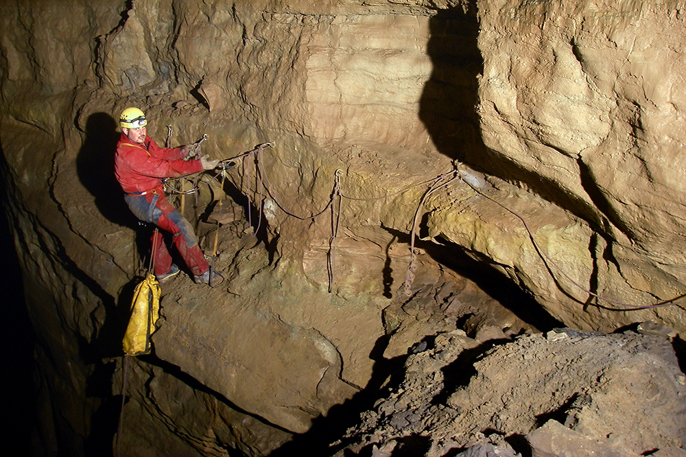
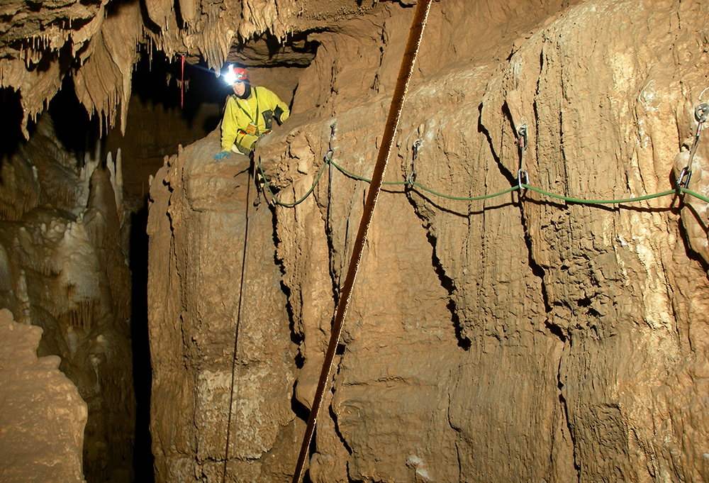
John Harman makes his way across a horizontal traverse, about 100 feet up in the air, to access Solstice Skyway in Cass Cave during a survey trip. Our team: Bob Zimmerman sketched, I recorded numbers, John Harman and Pete Johnson ran the instruments. It was a 15 hour trip.
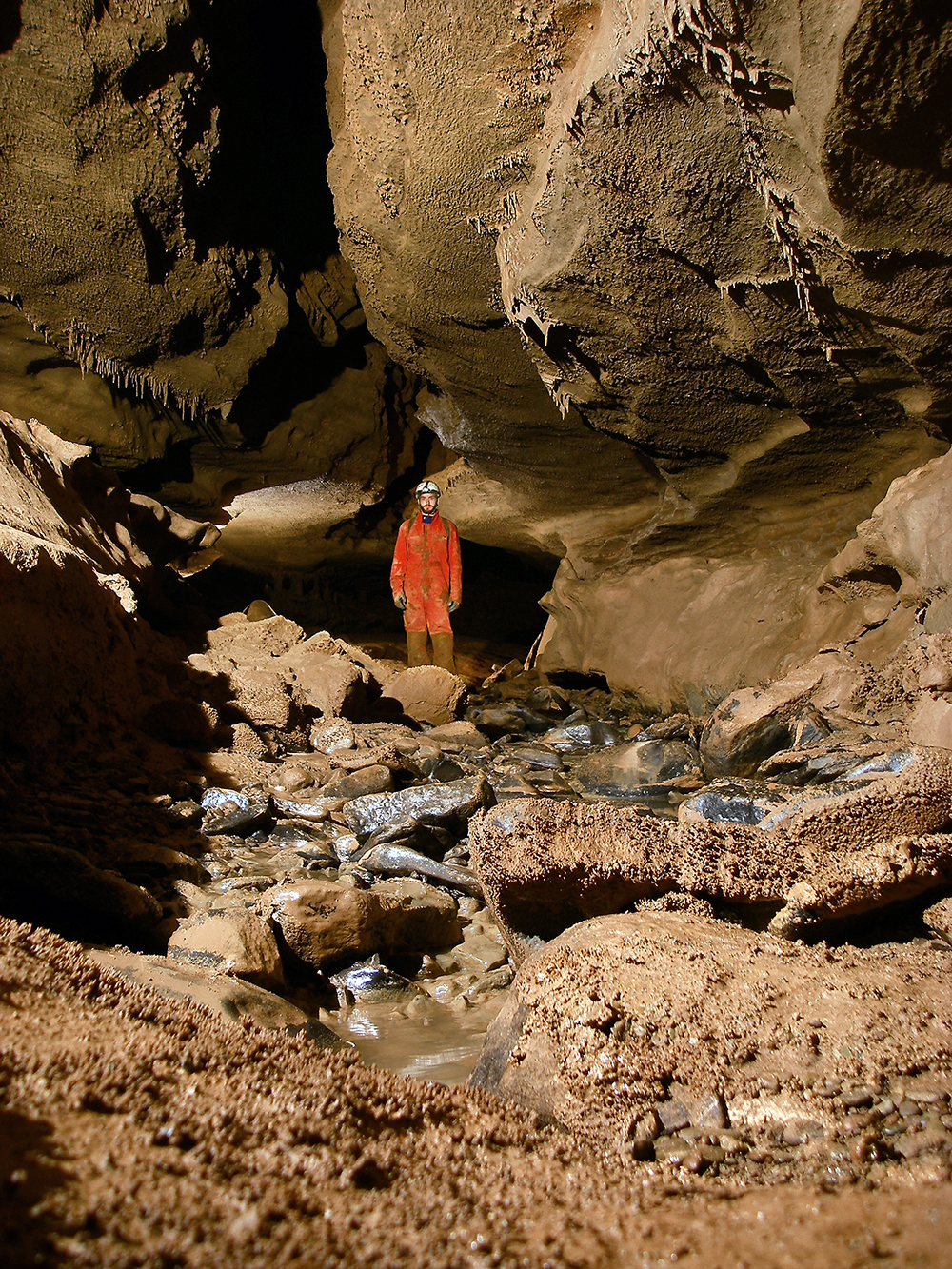
Here Pete stands in the Solstice Skyway passage.
As per Harman’s trip report —
“We quickly surveyed to a 15-foot climb up over a flowstone waterfall. I easily free climbed the drop and rigged a piece of Pete’s webbing to aid the ascent and to make the descent easier on the way out. Just after the climb there was another 10-foot waterfall climb. Pete took an alternate route around a huge chockstone while I climbed it. We met up on the other side and determined that my route was easier so we headed back down and surveyed to the top of the climb.
The passage here was floored with large sandstone cobbles. Just after the climb, the passage split and we debated on which way to go. Bob suggested we survey the left hand fork that appeared to go to a tight canyon. The canyon ended after only a few shots at SSB15. We retreated and surveyed the right hand passage. This passage was obviously the continuation of the main canyon. The height had decreased to about 8’ but generally remained about 10’ wide. We surveyed up a very slick, gently sloping mud floor that we dubbed the Ice Rink. Just after the Ice Rink, the passage split again and again, we surveyed the left hand fork first. This passage ended after only two shots as sediment choke. There were many beautiful formations and helictites in this area and we even found a double helix stalactite!
Next, we surveyed the right hand lead which jogged around the corner and opened back up into the main stream passage. This yielded two more shots to a 7” bedrock squeeze with great air. Pete was the only one who could fit and he reported scooping 50’ in going passage with several leads. After Pete returned, we decided to call it a day and head back out of the cave.
In total I believe we surveyed about 780’ of wonderful virgin passage! ”
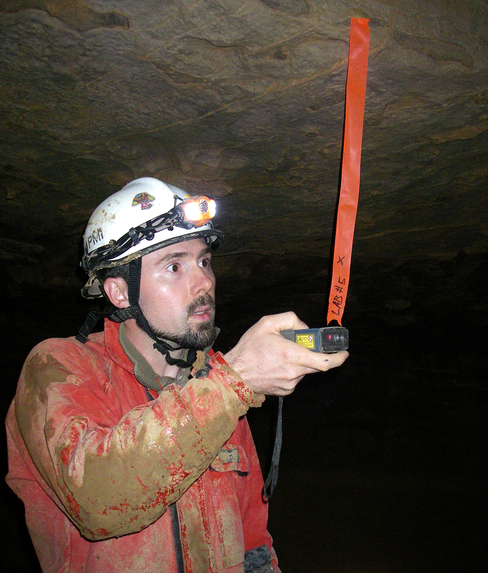
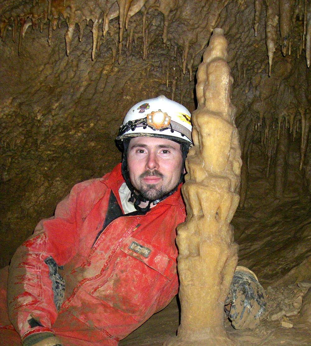
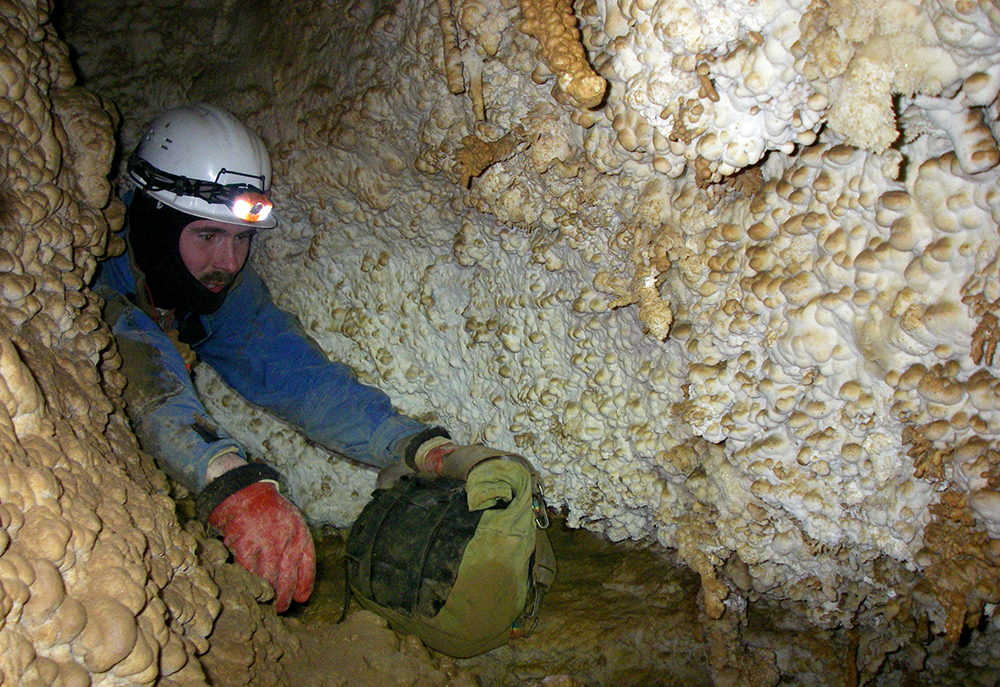
Chris takes a shot during our breakout in MDC . . . notice how much air is blowing the station! With Abby Hohn, Chris and I we surveyed 27 stations and 1,140 feet of passage in an 15 hour trip.
Memorial Day Cave Trip Report
LAB and LAC survey
by Nikki Fox
Chris Coates and I arrived at the Gateway Saturday morning to join about 20 others for a hearty breakfast. There were a couple of other day crews for MCD there and it was nice to see faces that normally go on camp trips. Abby Hohn volunteered to join us and we were exited to have a three-person survey trip to our lead for the first time. It was also Abby’s first trip into MDC. And boy, was she in for a awesome trip!
We drove up to the farm and got dressed. Our team was the first underground at 10:30 a.m. The second team, which consisted of Pete, Aaron, Pete and Gayle caught up with us at the rigged climb downs before the 50-foot drop. As you could guess, there was a little backup in the Puppet Buster for the drop into Columbia Canyon. I must note here that Abby said several times during the trip “I love this cave,” even during the PB the first time.
When our team was down, we boogied onto our lead. Once we made it to our last station, LAA 11, I handed out the survey gear and got comfortable to start sketching with the LAB survey. Chris started to do some recon for the next station when he found an amazing discovery! There was a small slit in the rock above. Crawling a few feet further, it broke open big enough for a person to fit through! This was the kind of passage we have been hoping for since working on the lead since April . . . passage that could possibly connect with the other side of the mud-choked western end of Columbia Canyon.
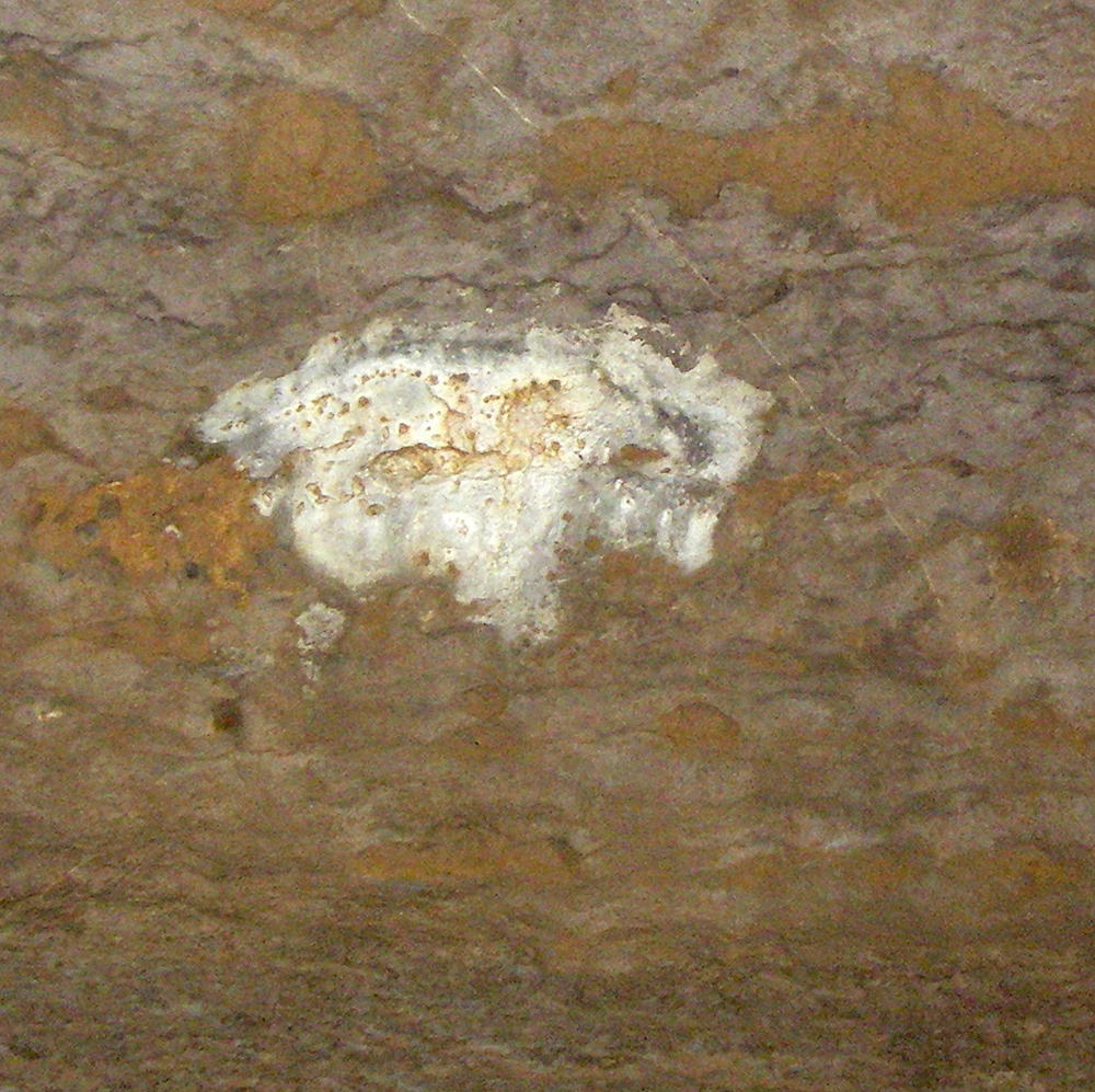
When Chris climbed into the room above he hollered, “I see petroglyphs!” Come to find out there were not man-made works of art on the cave walls, but a white blob of calcite that looks like a bison on the wall. We referred to the breakout room as the “Bison Room” all day.
Once we made our shots into the room, we left our packs to check out the booming passage before us. After walking around for a while, we decided which passages to survey. We made one shot to the left passage, which was trending northwest, and then headed north on the right-hand passage from the Bison Room.
We got to the first intersection (at station LAB 5) in one 83-foot shot from the Bison Room. Here there were four ways to go: a small crack in the floor that connected with the left-hand passage from the Bison Room (it was not tied into the survey, but Abby tried to get through the crack), a high lead to the northwest only accessible by a bolt climb, an interesting keyhole-like small passage sloping downward continuing north and the obvious borehole continuance to the southeast.
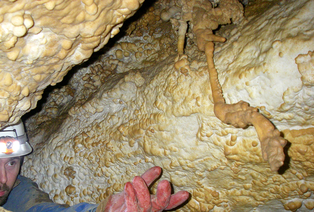
We chose to survey down the smaller passage, being it was heading the direction we wanted to go — down. It went down and down until it choked out with mud at LAB 9. We think this site would be a good candidate for a dig in the future due to the strong air sucking into the crack. We left three leads in this area and continued to survey straight. The passage became smaller. So small, that in fact we had a tight crawl to access the next room. This room was highly decorated with soda straws and helictites.
Upon exploring this room more, we made the greatest discovery of the trip. There was a window in the north wall about 7 feet from the floor (near LAB 13). We had to help each other up the wall to see into the blackness . . . it was the connection to the other side of Columbia Canyon! When in the window, you were looking down into the typical CC passage: narrow and deep (at least 80 feet to the floor). After discussing this find for the past couple of days, Chris and I have settled on the name of Nebraska Canyon for several reasons, but mainly for honoring my home state known for its infinite flatness.
We surveyed the rest of the passage and then headed back to the first intersection room to continue following the main passage trending southeast. From here we chose to change our station designations from LAB to LAC. The passage was about 15-20 feet wide and averaged about 15 feet tall. After a several shots we came up a beautiful formation between LAC 3 and 4. A three-foot tall stalagmite towered in the middle of a turn, frozen in time, all alone. A little over 100 feet more of surveyed passage and we came to a huge flowstone column that was blocking most of the passage. This feature was very unlike the rest of the passage and easily the largest speleothem we encountered.
Around the next bend in the borehole were more helictites and a little pool of water coated in thin calcite sheets floating on the water. The pool was extremely shallow, probably no more than an inch. From this point, the passage continued to become more decorated. Stalactites, helictites and flowstone became more common. Pretty soon the passage gave way (around station LAC 9) to a flowstone-covered floor at which the dirt underneath was washed away in places. The floor protested, cracked and moaned at our weight. There were some places that simply broke underneath our footsteps.
About 555 feet into the LAC survey down this lazily-meandering passage we found a large cluster of formations taking up the width of the passage. I stopped here to document it with my camera between data recordings. We ended the survey around 9 p.m. after the passage made an abrupt downward turn. We took one more shot down a slope that Chris was the only one of us to go down. He described it as “basically where the mud stops and clean rock with white formations start.”
“The area is wet and slippery, fragile and loose with rock. I think it is the start of a short well or dome. I could not get close enough to the edge to look over the bottom edge without a hand line to keep Nikki from getting too nervous that I may fall in. It doesn’t sound very deep and the passage seems to hang a 90 degree right turn before the drop off, but I could not tell for sure. There is also a consistent dripping noise coming from this area.”
Generally speaking, in all of the upper levels the floor was mud covered. There was very little breakdown in the passages. We did notice airflow in this upper section. At one station, the tape was gently waiving around in the air (LAB 5).
We took about 3.5 hours going out and did not run into anyone else along the way. Abby did not share the same enthusiasm and love for the PB when heading out as she did when trekking into the cave. We arrived back at the filed house to awaken Pete Penczer and share the discovered loot of our trip with everyone.
Chris and I will be unable to make the normal GVKS weekend in July due to our El Cap expedition. But we plan on returning as soon as possible to rig and drop into Nebraska Canyon and survey our left leads.
The numbers:
15 hour trip
27 stations
1,140 feet of survey
94.1 longest shot
The “bison” on the wall that Chris saw.
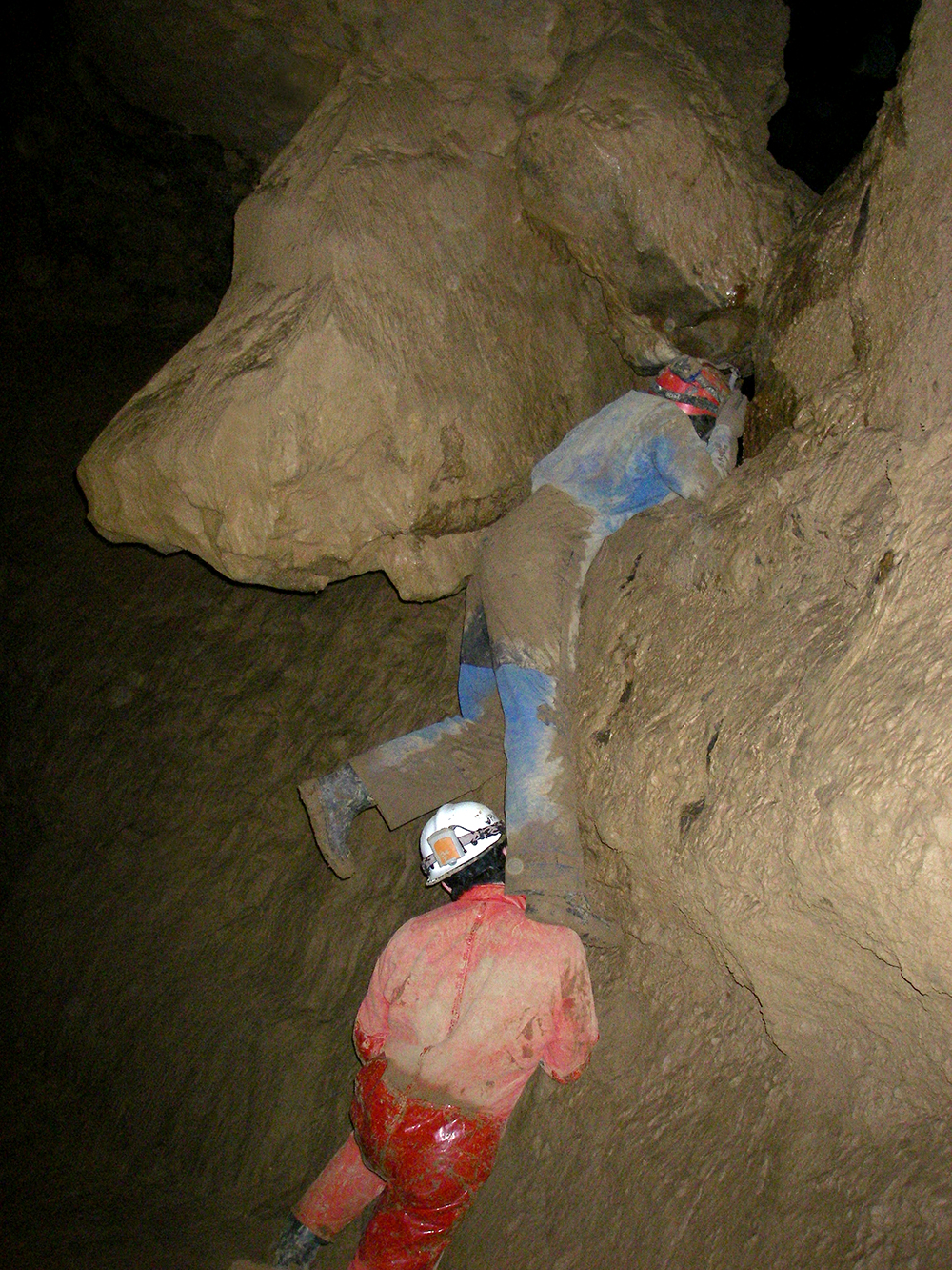
Here Chris gives Abby a lift to look into the massive canyon of darkness.
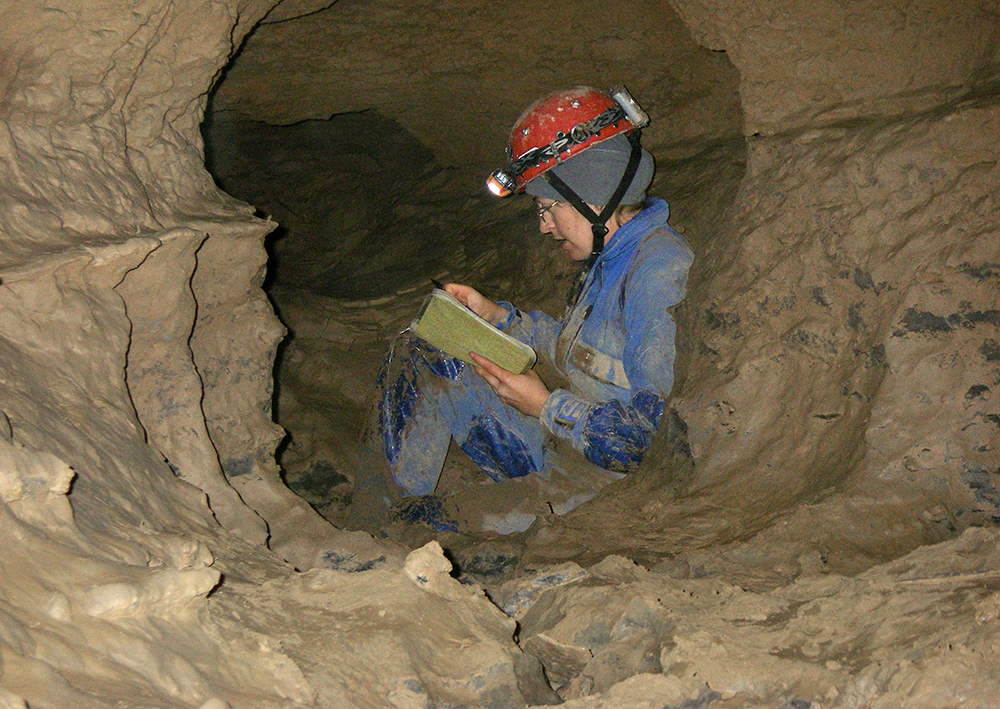
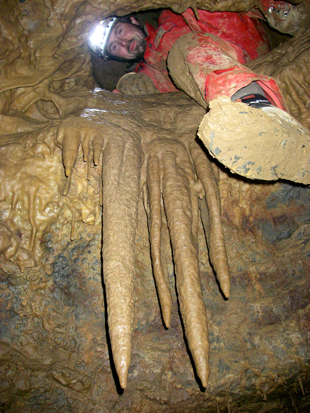
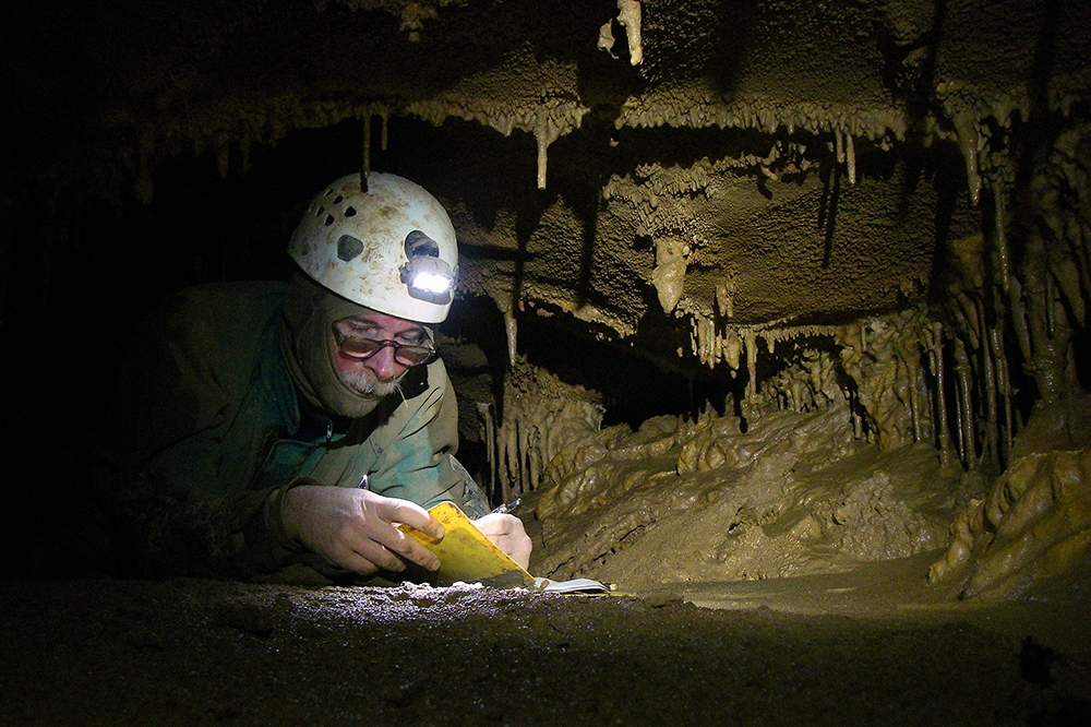
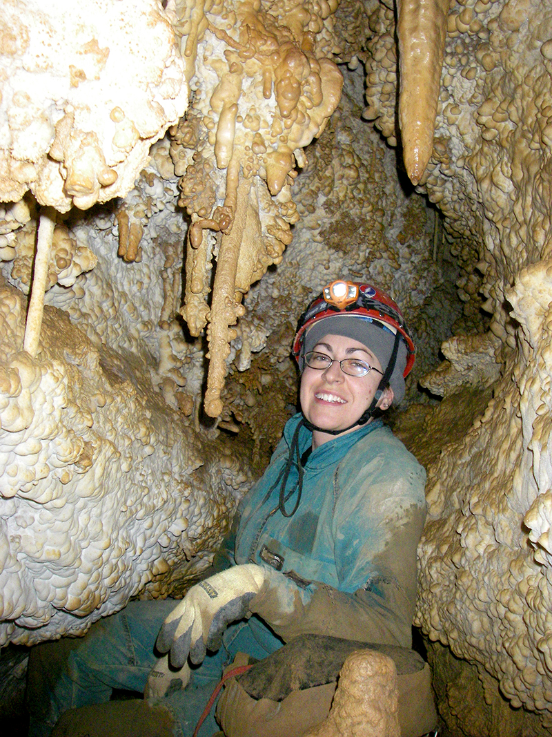
A rare photo of me . . . here I am sketching the passage during a survey trip with only Chris and I in MDC. We got 301 feet of crawling and stooping passage with LAA (Left Along Again) survey with 11 stations on a 15-hour trip.
Memorial Day Cave Trip Report
by Nikki Fox
Chris Coates and I meet the crew for breakfast Saturday morning at the Gateway for a hearty meal before heading underground. Our plan was to continue the survey on the other side of Harman’s Dig at the western end of Columbia Canyon. Our venture was almost cut short, however. When driving up to the cave, a gate was over the road next to the quarantine notice. We went back to the fieldhouse to see what the protocol was for such a closing of the area. Miles had us take him to the Ruddle’s to see was happening. It turned out they had the cows out in the fields around the chicken houses and had the gate down to keep them in. So we parked and got underground around around 10 a.m., without too much delay.
We made it all the way up to where we left off at FIS7 station in 3 hours. We brought 200 feet of 3/8 inch New England rope with us to dedicate to the area for the small pit we found the month earlier. We left it in some of the “larger” passage in the FIS survey.
Upon reaching the small room with several leads, we decided to check out the passage that went straight, which was along the same level. It was crawling for a while and the passage gradually became smaller. Eventually it branched into a Y with both leads being very small. The left one was too small for a person. The right one was slightly bigger, which was a passage fit for very tiny people, with air flow coming out of it. We did not survey this passage and decided to check out the high lead, which was back in the small room. This went to a beautifully decorated crawling passage with a couple of holes in the floor that looked down into the small room. So we decided to take photos and survey it with the LAA (Left Along Again) survey. (A joke Chris & I have going since last month Dave Riggs was going to come with us, but left word with the waitress at the Gateway Restaurant that he wasn’t going to be joining us. And this month Tim Bilezikian was originally going to come with us for a third person, and then decided not to that morning.)
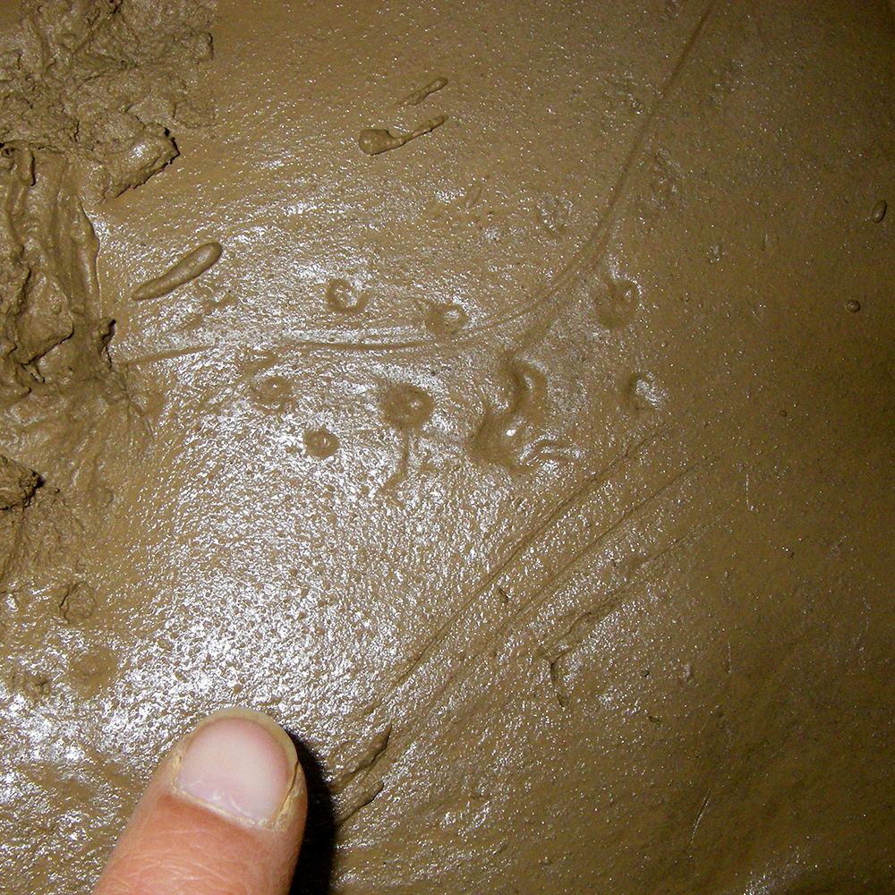
Again, this passage was coated in a thick, sticky mud and was mostly crawling with a few places to sit or stand up. One of the highlights of this passage was the discovery of animal tracks! We think the critter was a rat. In the passage we surveyed, there was a small pool of water with sunken tracks and scratch marks of the rat, probably struggling getting a drink of water. Also in this area were straight lines with really small tracks. I think these were from a salamander. We made sure to get photos of the area before we trampled the area with out footprints. (See below.)
We stopped surveying when the passage started getting smaller and the floor more rocky. I could feel my knees becoming like raw hamburger. We headed back to the small room where we started the survey and decided to check out the last unknown lead before heading out. There were two small holes in the floor that headed west. Upon crawling down, you were meet with beautiful formations and soda straws. It ended after about 10 feet of crawling to a crack in the floor and another small pit. This one looks a lot more promising than the one we found last month!
Another exciting find was a slot in the floor of a section that was between LAA5 and LAA6. We tossed in several small rocks to see how far down it went. We heard the rocks bouncing off the walls on average for 12 seconds. A possible way to the other side of CC?
The air flow of the whole area was more than last month. We got 11 stations and 301 feet of survey. The passage trended northwest. We will be back for more in June, hopefully equipped with better knee pads!
Chris looks down from an upper level during a project trip into Memorial Day Cave.
Memorial Day Cave Trip Report
by Chris Coates
Nikki Fox and I continued our dig/survey at the western end of Columbia Canyon off of John Harman’s dig/bolt climb. We surveyed 8 stations and gained about 235 feet of new passage in the FIS (see below) Survey.
The entire area is an extremely slimy muddy passage. We surveyed though the snug, sticky crawl. We didn’t notice any air flow until we where in the middle of the small crawl, where you could feel a cool breeze going by you. Once through, we surveyed until we reached the first intersection. We decided to bear left, where I went last time, which was the bigger of the two ways to go.
The passage got bigger, with walking and stooping. We made our way to a very small, highly decorated room that had several small crawling leads on multiple levels. The main passage continued straight ahead and went back to a crawl. At this point, there were several pretty formations decorating the area with only slight amounts of air movement, which was blowing out of the dig. Overwhelmed with all the crawling leads, we couldn’t decide which way to go, so decided to go back to the first intersection and survey the right-hand passage.
Once there, we made one shot to a tight hole in the passage. Once I went thought it, I was hanging over at a pit. The sides of the pit are fairly smooth and has no mud on it, unlike everything else in the crawling passage. You cannot see the bottom while looking into the man-sized pit without possibly falling into it. We could not tell from the top if there was any passage that connected to a lower level or passage. We didn’t have any rope with us so we decided to head out and come back next month with some rope.
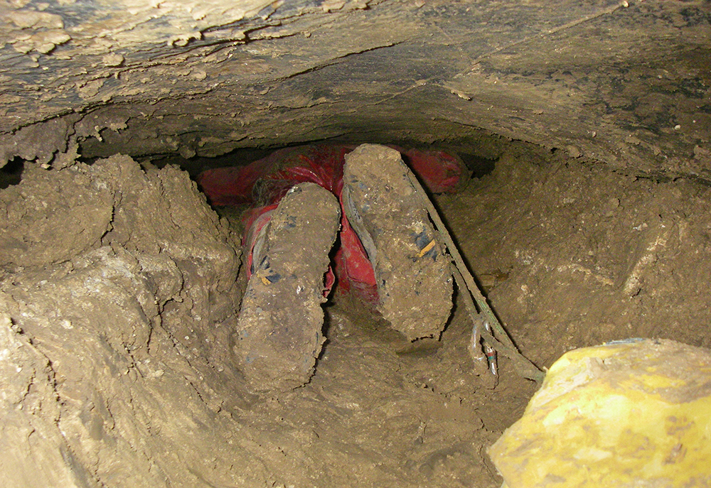
The beginning of the super-tight entrance crawl we dug out. Yeah, it’s tight . . . for 60 feet.
The main survey members look down a shaft that was dug open by West Virginia excavation crews blasting their way through a hill in Grant County, WV. When they found a cave, the site manager gave Bob Bennett a call to see what could be done about possibly checking out and surveying the cave to see where it went underground . . . a.k.a., to see if it would cause problems with building the highway later on.
So Bob made some calls and got together a survey team, which included me.
An article was written about our endeavors, you can read it here.
Scherr Crystal Cave Trip Report
by Chris Coates & Bob Bennett
The cave is developed near the top of a hill on New Creek Mountain about 2 miles North of Scherr, WV and about ½ mile east of Route 93. The arrowhead shaped entrance is about 5 feet wide and 9 feet long. The entrance immediately drops about 30 feet to the floor of the Entrance Room. The room is about 20 feet x 20 feet and is about 18 feet high and lowers to about 10 feet high to the back of the room. There is a very large flowstone mound that cascades down from near the ceiling just to the left of a slot. There are a few small formations that are scattered in the room.
Just offset from the entrance is a slot in the floor that drops about 10 feet to a larger room that the WVDOH said was big enough to set a 777 rock truck in. A hand line is helpful to get down the slope & 6 foot drop. There is a lot of breakdown and rubble lying in the slot. Most of the rubble probably came from the entrance area when the entrance was opened up and later stabilized.
The second room is about 20 feet long, 30 feet wide and 20 feet high. The room is shaped at an angle with the north side of the room 15 feet higher than the south side which seems to defy the dip of the bedrock. There is a ledge 10 feet up on the east side of the room with a body-sized hole that leads to the rest of the cave. There are some formations on the upper high side of the room.
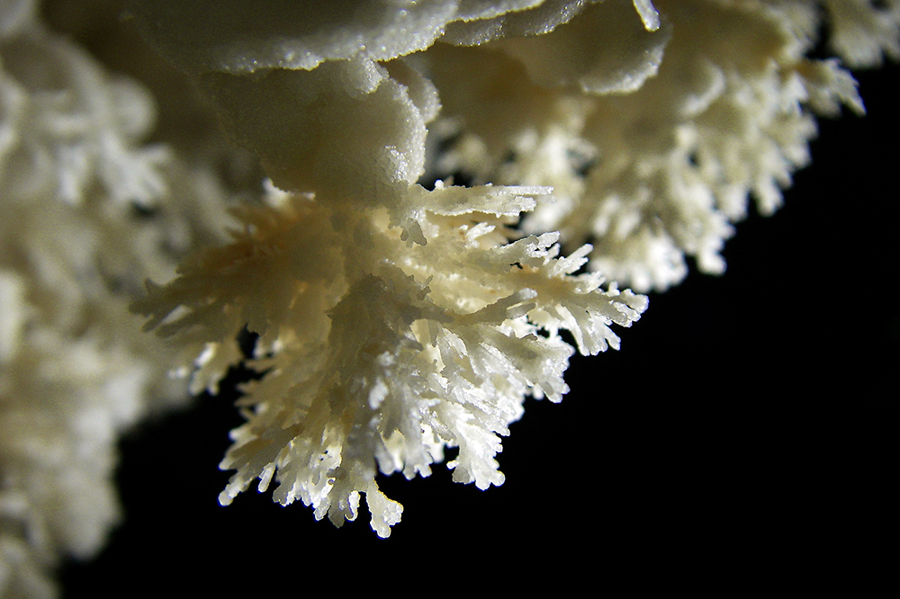
Once you squeeze through the hole you are in an area that is profusely decorated with aragonite crystals, frostwork, small bushes and gypsum flowers. The area is almost completely white.
Once you are through this area you are in another large room that again defies the dip of the bedrock. This room is 20 feet high, 20 feet wide and almost 20 feet long. Near the ceiling on the high side of the room is an opening that leads back to the second room. Again the high side of the passage contains formations. From this room is an 8-foot high and 5-foot wide passage that leads to more cave. To the left of the passage is a small shelf that contains many gypsum curls.
Within 10 feet this passage opens up into another room that is 25 feet high, 20 feet wide and 10 feet long. There again are formations near the ceiling of the high side of the room. Also a 10-foot long and 5-foot high passage at that level that leads back into the previous room.
From here the passage starts to trend upward. Within 20 feet there is another room that is 15 feet high, 15 feet wide and 10 feet long. At this point the passage shape seems to conform more to the dip of the bedrock with the higher points of the passage to the south and dipping to the north. At this point the cave is profusely decorated with stalactites, soda straws, columns, carrot shaped stalactites, and flowstone. One soda straw is between 15 to 18 inches long. The whole cave is very colorful but the color at this point becomes mind-boggling! Not only are the speleothems colorful but the bedrock is too! The colors include black, gray, blue, orange, several shades of red & rust colors, yellow, and white. Even the bedrock joins in with black, gray, silver, orange, and yellow. At the low point on the north side of the room is a hole that leads down to the Hidden Room.
There is a small crack in the floor on the left side of the passage. This is a tight hole that looks to go down about 15 feet. Once you go into the hole, you can see that the floor of the passage above is only about 8 inches thick. There is a high passage to access the bottom, or you can just continue down the main crack into the largest part of the room. The room has a sloping wall on the left with lots of loose breakdown and dirt. At the bottom there is a dry dirt covered floor with very textured crumbly walls. On the far side of the room (heading southeast) back on top of the loose breakdown, there is a ledge with a short tight breakdown passage leading back in the direction of the entrance. It eventually pinches out. The depth of this room is 39 feet below the entrance.
Once you are back in the main passage the trend is still up. After about 10 feet you come to a 5-foot climb-up. At the base of the climb is a small slot that leads down to the left toward a second pit.
There is a body sized hole on the left-hand side the floor of the main passage, which is on a slight climb up, toward the end of the cave. After sliding through this hole, being careful to mind the loose rocks all above, you find yourself sitting on a small ledge at the top of a 22-foot pit. The pit is not free hang but a very steep angled wall that requires vertical gear to safely negotiate to the bottom. The walls and floor are roughly textured. The entire time we were down there, there was water dripping from the ceiling and walls. The pit bells out toward the bottom with a small passage disappearing into a very narrow drain in the far wall of the pit (the northwest side). The depth of this pit is 41 feet below the entrance.
Back in the main passage after about 25 feet you come to another heavily decorated area with a very nice column in the middle of the passage. There is flowstone, bacon, soda straws, and stalactites. Most of the formations are to the right-higher side with the shape of the passage conforming to the dip of the bedrock. The passage is about 10 feet high near this point.
After another 10 feet the passage starts to quickly trend upward with the ceiling height about 3 feet. There are a lot of bacon formations in this area with lots of flowstone. Passage shape flattens out here but heads into very thin beds. Lots of slabs occur in this area. The passage pinches out in the thin beds. At this point the cave is 8 feet above the entrance.
The whole cave contains many formations. But several areas are very heavily decorated with just about every type of speleothem. You have to be especially careful as you travel through the cave in many areas.
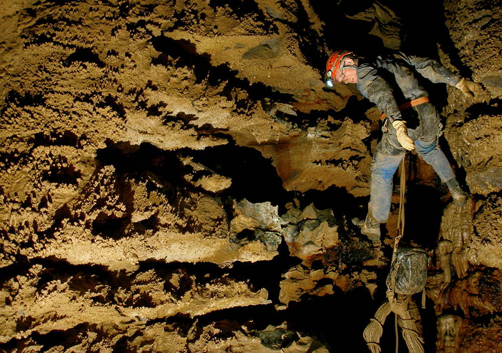
This is me going down the 17-foot entrance drop. Photo by Bob Bennett
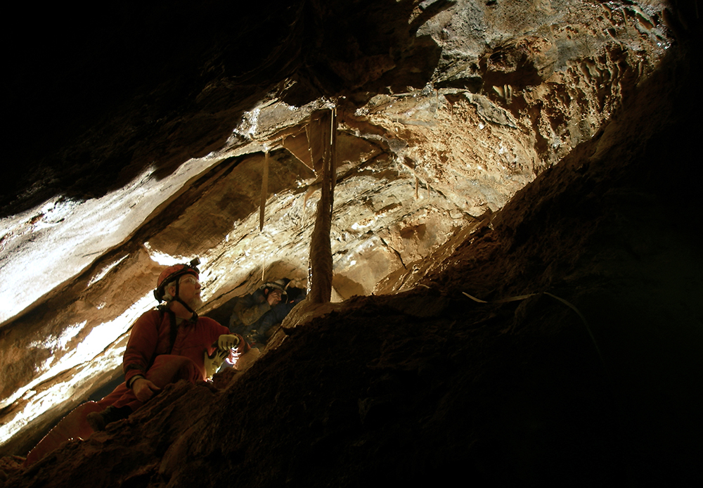
Here is Terry Mcclanathan rappelling into the cave.
Kurt Waldron reads instruments in a pretty constriction.
Some of the beautiful frostwork found everywhere in the cave.
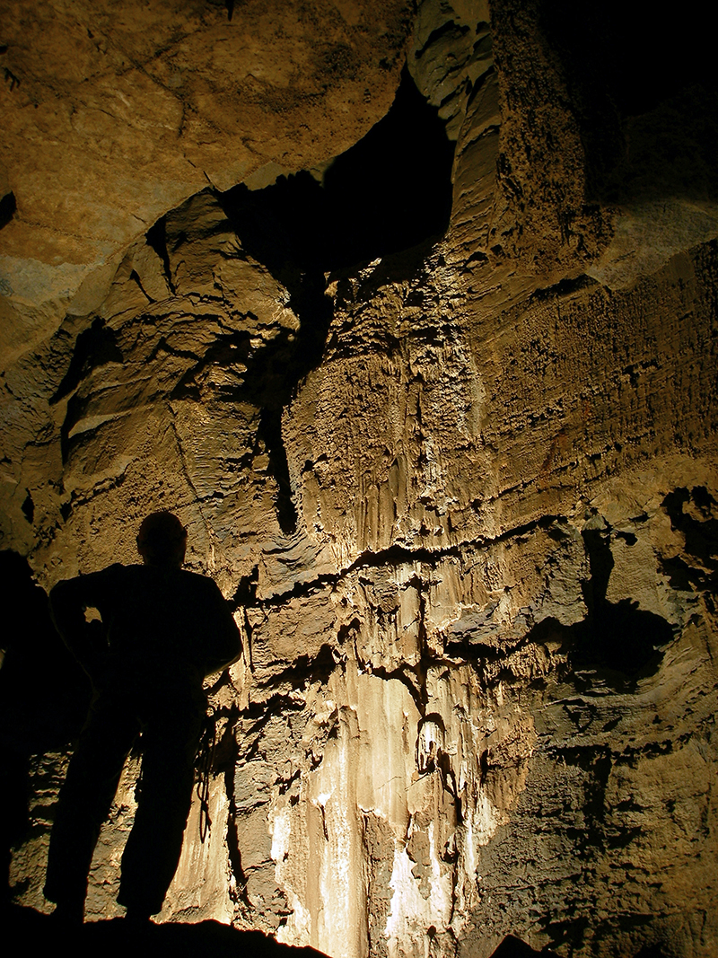
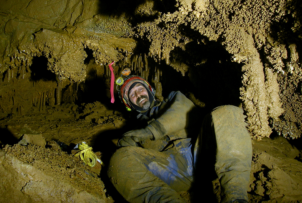
Bob Bennett sits near the end of the cave, checking out a column.
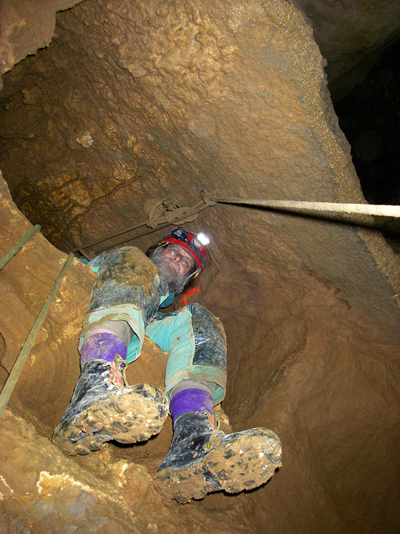
Dwight Livingston checks to see if the rope or his cave pack he is hauling, while ascending rope, is snagged during a project trip into Shoveleater Cave.
Dwight stands next to the Vomitorium in SEC.
Shoveleater Cave Trip Report
Harper Canyon Detail
by Dwight Livingston
No survey.
Killed multiple leads.
Photographed decorated areas.
Chris Coates, Nikki Fox and I entered about 11:15 am and went directly to the northern Harper canyon overlook via Ohio Bypass. We found the rigging at the HHH bolt climb a bit worn at a rub point, just enough to make a floppy place in the rope. Our first objective was to rig a hole at the bottom of the Harper Canyon Drop (86 foot drop) and check leads along the northern wall of the pit below it. We found numerous holes to the domes below, both to the upper pit of the E Drop series and to the Devils Drop bridge, which includes the top of the upper E Drop. The wall that separates the two pits is intriguingly thin, and a number of irregular holes connects them. A lot of loose rock at the top complicates any sort of rig there. It seemed that no amount of grooming would make it clean enough to be safe. The danger is aggravated by a areas of crumbling bedrock.
Our first rig took the survey laterally north, over the top small breakdown piles and down to a waterfall shelf. From that point the entire north end of the canyon can be seen. There are no leads, except up into the shallow breakdown of Harper Canyon. We surveyed it to define that end of the pit profile.
We next rigged down to the “bridge” at the Devils Drop. This was a safe route but on top of flowstone, not suitable for a permanent rig. Once down, we rigged a tether to go over to the TBJ survey. In the far pit Chris checked the canyon lead and found it too tight after going in more than twenty feet. I sketched plan and profile. (Today I also tracked down some shot data that was entered incorrectly, so now TBJ1A lies in the correct position – another mystery cleared up.)
Nikki brought camera and flash gear, so we took a couple of pictures of Mark Minton in the Harper Canyon ceiling, then traveled over to the BR survey to photograph the Vomitorium wall. There are some interesting red formations in another part of BR, and Nikki shot some of those also.
Our last objective was to check the location of station HCT3, which looked a bit out of place when I tried to fit that survey into the working map. I shot it from above the balcony and tied to BAT 11.
That done, we crawled out to station CFA7 and squeezed out onto Robins Roost, an interesting shelf high in Harper Canyon, directly above TBJ survey and the E Drops. It was here that Bob Robins, on his way up the Harper Canyon Drop, accidentally got off rope early and was therefore first to walk the shelf. We had a fine view of Bob Alderson as he descended spider-like from a hole in the ceiling.
It was a short trip out from there. I exited first, around 11:30, and surprised a group of deer near the entrance. They bounded a few yards off and stood, five pairs of white eyes in the black woods.
This weekend we put up a new copy of the working map, one that Gordon was kind enough to print last minute. Among other discussions of what proper name should be used for this and that part of the cave, I talked with a few people about what to call the cave itself. I’ve seen both “Shoveleater Cave” and “Shovel Eater Cave” in use, and for me there is value both in original names and in common usage. In this case it seems the original Shoveleater Cave is preferred, so I will be changing the documentation accordingly.
I believe it would be helpful to have a permanent rig from the Devils Drop bridge up to Harper canyon. This would make an easier route out from Germany Well, via Ohio Bypass. It probably should go over the breakdown and not though it, to avoid the rockfall hazard.
Vonny Droms sits at the top to Holy Water Pit during Shovel Eater Cave survey trip.
Bottom, is Mark Minton sitting at the top of the new 102-foot pit we surveyed in SEC. Shovel Eater Cave Survey Trip
by Mark Minton
Participants: Chris Coates, Yvonne Droms, Nikki Fox and Mark Minton.
Taped a new 102-foot pit in Rubicon Hall, next to the Holy Water Pit.
RHB survey with 215 feet.
Chris Coates, Yvonne Droms, Nikki Fox and I went to Rubicon Hall to finish up vertical leads left from last month. Our group was the first in at about 10:40 AM. When I stepped on a large cobble embedded in dirt next to the squeeze just below the lid, it rolled forward and stopped precariously wedged in a slot. I couldn’t get it to come out so I left it. Bob and Carl later got it to drop further down the slot where it seems to be stable, although it changes the moves you can make negotiating the squeeze.
The cave was quite dry and there were not even any drips in the Ohio Bypass. At the bottom of the Bypass Yvonne tuned several of our racks so that the bottom bar would open more easily. It turns out that a Petzl bolt hammer has just the right wedge shape to open up a MicroRack bar if it is too tight. With most of our gear and rope already in place we then made rapid time to our destination. Our first order of business was to survey and descend the pit Yvonne and I found last month beyond the window at the top of Holy Water Pit. Chris and Nikki went across the J hang to the window and down to the ledge below it. Then I went across to help with the survey and derig. After Chris established that the new pit connected to the bottom of the left side of Holy Water Pit as expected, Nikki went down and I pulled up the rope and redeployed it down the main shaft. The new pit dropped 102 feet from the rig point at the window, which is at least 20 feet below the top of the climb we did above it last month. Since the climb had been derigged, the upper part of the drop could not be surveyed to establish the total depth. Nevertheless, Shoveleater has yet another 100-foot pit. Chris and Nikki also took advantage of the drier conditions to probe around for a way on below RHA5, but found nothing open.
While Chris and Nikki established the tie-in at the bottom, Yvonne belayed me back across the traverse at the top of Holy Water Pit as I cleaned the route. We then gathered up all of our gear and joined the others at the saddle between the two bottoms of Holy Water Pit. I had a bit of a problem on my way down when I discovered that the knots connecting two pieces of rope together were not quite on the floor. I had not bothered to untie anything when I dropped the ropes down the pit, so they were still tied to the quick links and bolt hangers from the rigging at the window. This would not be an easy mess to pass, so I swung into an alcove and untied everything. With all of the knots out I had just enough rope to reach bottom. Yvonne followed and we had lunch. While digging around in the mud at the bottom of the rope I found the sledgehammer that Ralph had lost over a year ago. It had been completely covered and was totally invisible, which explained why previous teams hadn’t found it. It was still in good shape, which was fortunate because we needed it later on.
Our final objective was a hole in the wall of an alcove above RHA6. The alcove wasn’t very far up, but there was no obvious usable route into it. The main pit wall was mostly covered with thick mud and very rotten flowstone. However there was clean rock past the alcove and above the right-hand bottom of Holy Water Pit, so I devised a route up beside the alcove followed by a traverse back into it. This went well and I was standing in the alcove after four bolts. The walls of the alcove were covered with popcorn but the rock was good. I made it to the top after three more bolts. Yvonne ascended the static rope I rigged and cleaned the climb. Then Chris and Nikki came up.
The passage at the top of the alcove actually went down slightly, and then after six feet dropped into a tight pit. Yvonne used Ralph’s hammer to open it up large enough for her and Chris to get into. There was also a tight canyon above the pit. Unfortunately neither passage went. It is likely that the tight canyon above the pit is a lower level of the SAS survey done in the floor of the large passage continuing beyond Rubicon Hall. There was surprisingly good air flow in this lead, as there was in the window back at the top of Holy Water Pit. Since both of these leads loop back into known cave, I guess the air is just circulating. We surveyed our find and then descended, pulling down the rope behind us.
Having accomplished our goals, we ascended Holy Water Pit. On the way up I checked the remaining lead, which was a narrow slot in the wall about 20 feet off the floor. It was way too tight to follow anywhere. Further up we found an old glove in a narrow infeeder near the top of Holy Water Pit, which we brought out. All ropes and rigging have once again been removed from Rubicon Hall. We took all of the ropes and climbing gear to HHH15 and left them for future use. As we approached Hellhole Hall we met Dwight’s group, which was exploring a lead in the HEX survey. We passed them and began our exit up the Ohio Bypass. As we were climbing Bob and Carl arrived. Everyone was leaving at the same time. Yvonne and I got out at 11:30 PM after a 13-hour trip. It was a beautiful, warm night.
So Shoveleater has yet another 100-plus-foot drop, but we had to derig it because we needed the hardware and rope. Sorry Terry.
A survey trip in Shovel Eater cave with pals Carl Amundson and Bob Alderson. We rigged and rappelled into a new pit (Wet Russian, 57 feet) at the bottom of Chumazik Pit (137 feet). Above is Carl ready to shoot at a station.
Below is Bob sketching a highly decorated crawl alcove. We found bat calcified bones in flowstone and some larger bones, probably from a rat. The trip was 17.5 hours long.
Shovel Eater Cave Trip Report
Monday, March 9, 2009
by Nikki Fox
Participants: Nikki Fox and Chris Coates
Monday morning rolled around and the Daylight Saving Time change was effecting both Chris and I. After taking to the Harpers we finally made it in a little after noon: not the early start we were planning on.
We were careful to notice any and all bats along the way. No signs of WNS. No signs of WNS bat behavior. In fact, hardly any signs of bats at all.
We trucked into the cave via the Ohio Bypass and went straight to our destination: the continuation of our OWP survey from February. We designated the new survey from OWP16 the OWU survey. Along the slot canyon survey, at station OWU8 we made a shot to a window in the floor that looks into the room below. We named this station OWU9. We knew we would later tie it into the room survey at some point. We made 13 stations into the Column Room.
We ate dinner once in the room and surveyed it using the designation of POP. At this point we wish we had a Disto to measure the ceiling of the room. A huge column sits in the middle of it and made for some interesting shots to go around it.
Once the room was done we decided to tie in the window shot (OWU9) from earlier in the day. I went back to the window with the tape to get the vertical measurement. It measured 14.1 feet and was marked PAP1 at the bottom, which we tied into POP5. From this vertical shot we were able to determine that the ceiling, which the window was about half way from the floor to the ceiling, was approximately 28 feet high.
We left the lead at POP1 for later. It is a very small crack in the floor where the water goes. Chris went in it last January. It goes down to the flow of water and is passable with a belly crawl through the water. After three trips into SEC, each one was in this tight, winding canyon, we want to take a several month break from this section.
On the way out we noticed that the Ohio Bypass rope is suffering some damage from wear. I don’t know when this rope was put in, probably soon after the Ohio team broke it open in February of 2008? But there is an abraded section a couple of inches down the tight spot before you get to the redirect. I noticed this when climbing out. I did not notice it when rappelling, probably due to the fact that the water and mud was matting the fraying down. It does not appear to have worn to the sheath, just something to keep an eye on in the future.
The Numbers:
Survey: OWU, POP and PAP
Leads Killed: OWP and OWU
Leads Left: POP1
Surveyed Passage: 212.7 feet
Trip Length: 14 hours
Another work weekend in Shoveleater Cave. This awesome antler formation was found at past the LAZ survey.
This is me in the tight passage. Unfortunately, we forgot to pack our survey tape, so we did not get any work done! Shovel Eater Trip Report
January 12, 2009
LAZ Non-Survey
by Nikki Fox,
Trip participants: Chris Coates and Nikki Fox
Chris Coates and I entered the cave a little after 10 a.m., Saturday. We decided to go the old route into Hell Hole Hall, avoiding the Ohio Bypass and its water. We knew we were going to be in a tight space while continuing the LAZ survey, which Chris and Dwight made in November, and wanted to avoid being wet at all costs.
Our plan was to continue the LAZ survey where it opened up into a room. Chris found this decent-sized room last November. From what I’m told, Dwight and Chris pushed the canyon after the last station until Dwight could no longer fit due to the formations. Chris continued for about a half an hour on his own until he found the passage to dump into a room.
After entering HHH Chris and I meet up with Dwight and then headed towards HHA11 to drop down into the slot canyon at KNC4 heading downstream to the LAZ survey. Dwight seems to think this is can be called the Upper Rushin’ Rift? (LAZ report from November 2008). We made it back to LAZ 14, where a large breakdown rock choked the passage and proceeded to unpack our survey gear only to find we had forgot our tape! I was upset since I really wanted to take a stab at sketching.
We decided to rectify our forgetting ways and push the passage back to the room to check out all the leads while taking photos to document all the pristine formations along the way. We knew if anyone else larger than either of us were to try to make the journey the gentile helictites, stalactites, columns, frost and soda straws would be destroyed. (I would upload the photos from the trip if the GVKS website would let me.)
An interesting note: we found many of the formations to have an amber tint to them. Soda straws had amber tips on them and on rare occasions the entire straw would be a translucent amber. There were several “antlers” in the passages on all the levels of the slot canyon. I call these huge, thick and massive helictite formations antlers.
Once we dropped into the room we ate lunch and proceeded to check every lead in the room. Below the a waterfall there was a small pool of water that drained further down into the floor too small for people to follow. There were two places to drop down below the floor into the same type of canyon passage as we took to get into the room, only smaller. It looks like a continuation of the same passage we came from, following the water downstream, deeper into the cave. We pushed one of the two slots the farthest we could on all levels and could not get past a certain point due to our bigness. I left a note at this small-person lead.
It was also in this passage that we had rocks fall on our heads from above. Apparently Bob and Aaron were above us near the HHA7 station and kicked a rock down the slot. We heard their voices and were able to tell them where we were. They decided to join us.
The Numbers:
Survey: LAZ (well, sort of)
Leads Found: 1